The 1863 Lake Map. Lot 3. Source: www.islandregister.com. Note Centerline Road is marked "Proposed Road"

Sunday, January 27, 2013

Centerline Road (Rte.151) Alma

     The Centerline Road in Alma goes east and west from the Western Raod (Rte. 2) taking the district of Alma to the east to Montrose and to the west to Lauretta and St. Lawrence.  Wilbert Jeffery recalls  in the summer of 1956 the government improved the Centerline Road from the Western Road down to the Klondike Rd. (today the McLellan Rd).  Wilbert Jeffery was asked by road-overseer Stanford Greene (he took over from Roy Burns) if he'd like a job working on the road.  The equipment was fairly basic, shovels and a bulldozer.  Wilbert recalls the dozer operator was Alfred Cormier (d. Sept.2011) of Waterford.  Wilbert's job was to move away the stray rocks and brush that came put on the road from ditching so cars passing wouldn't be damaged by the debris.
     The following year, 1957, the power poles and lines were brought into Alma and Lauretta - from the Western Road in to the Klondike Road.  About half of the residents on the road connected.  Wilbert recalls a neighbour saying, "I couldn't afford to buy the kerosene last year, so I don't think I'll be able to wire the house and connect to the electricity."  At the time Wilbert also recalls Premier Matheson saying, "we're paying 90% of the cost to put the electricity through the countryside."   Wilbert & Verna Jeffery got power to the Stephen/David Jeffery Homestead in 1964.     
 
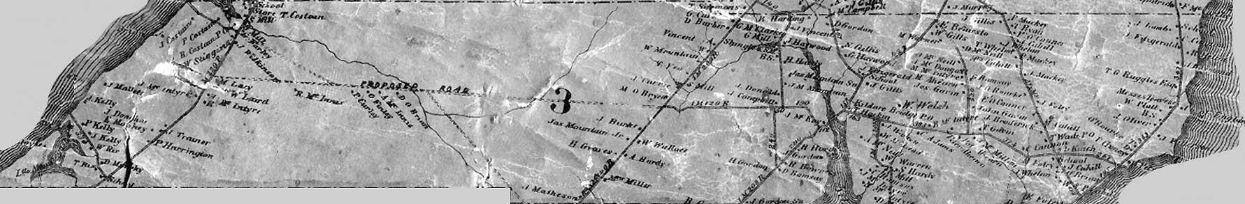
     The Centerline Line Road was the road cut through the middle of Lot-3 from St. Lawrence to Montrose - it was the "center line of Lot-3".  In the 1863 Lake Map above you can see that it was first known as the "proposed road".  Click on map to enlarge.

No comments:

Post a Comment